A Look at Google Map's AR Future
Google has provided an early look of the Maps application enhanced with Augmentet Reality features.
The a new navigation system was first announced by Google during
last year's Google I/O, and has started to test the system with real users, starting with a small group of Local Guides.
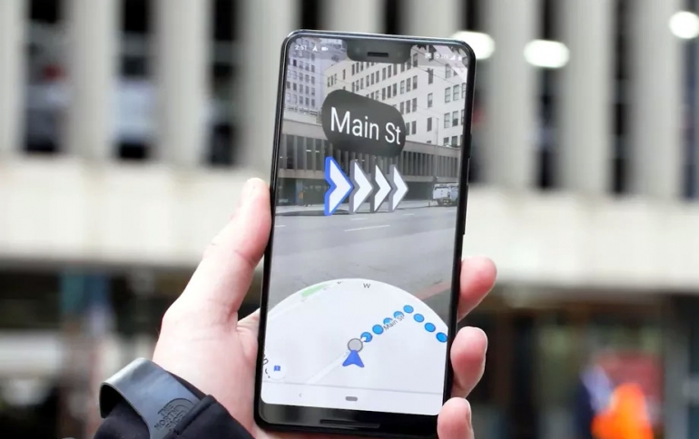
The Wall Street Journal’s David Pierce got to try out an early version of the feature, which essentially it provides images of the real world with Google Maps layered on top.
Augmented reality navigation apps use smartphone cameras to get a detailed sense of where you are and put signs and arrows on top of the real world.
According to the WSJ, you can open up Maps, hit the Start AR button, and Google Maps will guide you using the new system. The system first picks your location via GPS and asks you to move your phone around so it can determine exactly where you are. Then it provides directions based on that. You can hold your phone up and Google Maps will give you actual directions in the real world.
This app also warns you to put your phone down, and only check the directions momentarily, in order not to walk around looking at your smartphone only. This also helps save your phone’s battery as the experience simply switches to the regular map interface when you put your phone down.
The feature provides people with very specific location location data, and it will likely also appear in AR-capable glasses.

